After a slow start this morning, we decided to make a loop around the area — about 150 miles — visiting Valley of the Gods, Mexican Hat and Natural Bridges National Monument.
Valley of the Gods was billed as a smaller version of Monument Valley, and it lived up to it. Plenty of red rocks catching plenty of sunlight… and clouds, but more on that later. We toured around the area, along a 17 mile road that went from gravel to rutted and back again. Frankly, the Acadia did well with the unimproved road.
However, I had a little less sure footing. Early in the drive, we stopped to take some photos, and I climbed atop a little knoll to grab some images. When I came back down, the rocks shifted, and I tumbled pretty well down the hill. The good news was that I tucked the camera (and my noggin), and rolled pretty well into a three point landing — my left hand, my right knee and my right hip. 🙂 Nothing bad, but some pretty good bumps and bruises. I’ll survive.
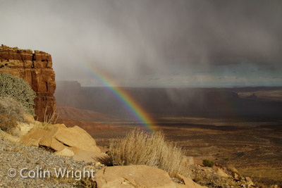
Once we were done with Valley of the Gods, we zipped down to Mexican Hat for a little lunch, before heading up the road to Natural Bridges National Monument. To get there, we had to travel across Moki Dugway, which is a crazy unpaved road with tremendous switchbacks, no railing and terrific views. Remember those clouds I mentioned earlier? As we started up the road, the clouds began to produce a little bit of rain, and after turning a corner, we saw a tremendous vista with a wonderful rainbow! It was absolutely stunning. We found a place to pull over, and snapped quite a few images. Way cool.
When we got to the top of the hill, we started getting into colder weather, and some rain from the clouds we’d spotted from down in the valley. And then the snow came. Yep, snow. In fact, a snowstorm. The flakes were huge, and coming down with a vengeance. It snowed on us for about 45 minutes, right up to the entrance to Natural Bridges NM.
Natural Bridges was great, and definitely out of the way. In fact, I wouldn’t have been surprised if we were the only people there today. We got our parks passport stamped, and took the nine mile drive through the park. Nice drive, and the bridges were nice to see from the overlooks. In theory, we coulda hiked down to some of them, but with me having already put myself down a hill today, I figured I didn’t need to tempt fate.
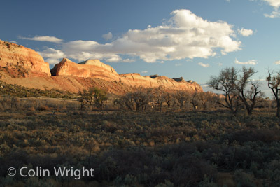
From the park, we headed toward Blanding. This was pretty much a big ol’ downhill drive, leading to the base of Comb Ridge. Comb Ridge must run dozens of miles, and was catching the sun just right. We found a place to stop at the base of the ridge, and shot down the length of it. With the fading sunlight, it was simply amazing.
By the time we got back to Bluff, we’d been on the road for almost seven hours, and some of the best photography and weirdest weather I’ve seen in quite some time!

